- Home
- About Us
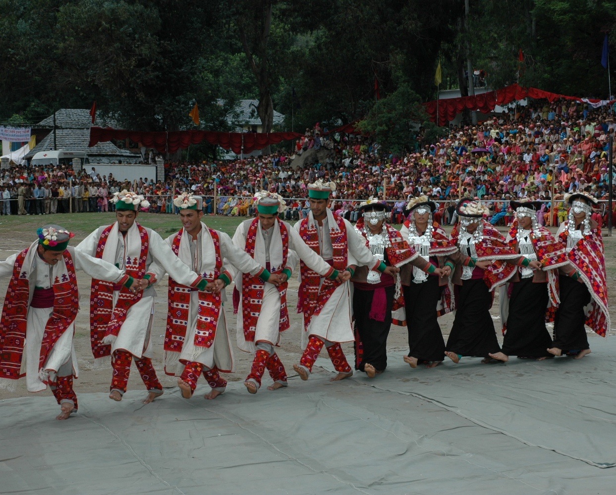
- Tribal Areas
Tribal Areas
Himachal Pradesh is situated between 300-22’-40’’ to 330-12’-20’’ north latitudes and 750-45’-55’’ to 790-01’-22’’ east longitudes. The altitudes in the Pradesh, a wholly mountainous region in the lap of Himalayas range from 350 metres to 6975 metres above mean sea level. It is surrounded by Jammu and Kashmir in the North, Tibet on North/North-East, Uttar Pradesh in the East/South-East, Haryana in South and Punjab in South-West. Physiographically the State can be devided into four zones viz.(i) Wet such temperate zone comprising of Palampur and Dharamsala of Kangra District, Jogindernagar area of Mandi Distt. and Dalhousie area of Chamba District (ii) Humid such temperate zone comprising of Kullu and Shimla Districts and parts of Mandi, Solan, Chamba, Kangra and Sirmour districts (iii) Dry temperate-alpine high lands which include major parts of Lahaul-Spiti, Pangi and Bharmour of Chamba Distt. and Kinnaur (iv) Humid such tropical zone comprising of Bilaspur, major parts of Mandi District, Nahan area of Sirmour district, Bhattiyat valley of chamba district, Nalagarh area of Solan District and Dehra and Nurpur areas of Kangra Distt., Paonta Sahib area of Sirmour District and Indora area of Kangra District. Due to the seasonal variation, the climate of Himachal Pradesh varies at different altitudes. The average rain-fall is 152 cms.(60 inches).
According to Surveyor General of India, the total area of Himachal Pradesh is 55673 square Kilometer which is divided into twelve administrative districts. Out of this total area, 32,271 square Kilometer is measured area according to revenue records of the Pradesh. The total population of Himachal Pradesh according to 2011 census was 6864602 and a density of population is 123 persons per square kilometer. The total scheduled castes population in Himachal Pradesh is 1729252 which is 25.19% of the total population. The Scheduled Tribe population of the Pradesh which has its concentration in districts of Kinnaur and Lahaul-Spiti, Pangi and Bharmour parts of Chamba and scattered in other district is 3,92,126 according to 2011 Census. The Ministry of Tribal Affairs, Govt. of India has notified Gaddis and Gujjers residing in merged areas of the State as Scheduled Tribes. More than 31.52%, the State’s tribal population falls under the Scheduled Areas of the State. There are vide variations in Area and Population figures of the districts. The legally classified forest area is 37597 square kilometer viz. 67% of which 21324 square kilometer is culturable forest area. There are 12 districts, 62 Sub-Divisions and 137 Tehsil and Sub-Tehsils in Himachal Pradesh (31-03-2014).
The main stray of the people in Himachal Pradesh is Agriculture on which 65% population depend. The topography being mostly hilly, the type of cultivation is terraced. Percentage of main workers to total population is 30.05 and the percentage of cultivators to total main workers is 57.93. The percentage of Agricultural labourers to total workers is 4.92.
Out of the total geographical area of 55.67 lakh hectares only 5.83 lakh hectares is the cultivable area in the State. Out of total cultivable area an area of 3.35 lac hectare is under assured irrigation.
In absence of railways and water transport, roads are the only means of communication in pre-dominantly hill State of Himachal Pradesh.
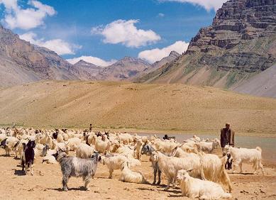
The Kinnaur and Lahaul-Spiti districts, in their entirety, and Pangi and Bharmour (now tehsil Bharmour and sub-tehsil Holi) Sub-Divisions of Chamba district constitute the Scheduled areas in the State, fulfilling the minimum criterion of 50% S.T. population concentration in a C.D. Block. These are situated in the north and north-east of the Pradesh forming a contiguous belt in the far hinterland behind high mountain passes and are amongst the remotest and most inaccessible areas in the State with average altitude being 3281 metre above the mean sea-level. The most distinguishing mark of the tribal areas in the State is that they are very vast in area but extremely small in population with the result that per unit cost of infrastructure activity is very exorbitant. The district of Kinnaur is located between 310-05’-55” and 320-05’-20” north latitude and between 770-45’-00” and 790-00’-50” east longitude. The District Lahaul-Spiti is situated between north latitude 310-41’-39” and 320-59’-57” and east longitude 760-40’-29” and 780-41’-39”. The Pangi Sub-Division of Chamba district falls between north latitude 320-33’ and 330-19’ and between east longitude 760-15’ and 770-21’ and the Bharmour sub-division of this district is situated approximately between the north latitude 320-11’ and 320-41’ and between the east longitude 760-22’ and 760-53’. Snow glaciers, high altitudes and highly-rugged terrain, criss-crossed by fast flowing rivers and their tributaries are the peculiar features of the Tribal areas.
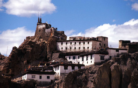
These areas have also been declared as Scheduled Areas under the Fifth Schedule of the Constitution by the President of India as per the Scheduled Areas (Himachal Pradesh) Order,1975(CO 102) dated the 21st November, 1975. The five ITDPs are Kinnaur; Lahaul; Spiti; Pangi and Bharmour. Except Kinnaur which is spread over 3C.D. Blocks, rest of the ITDPs comprise 1C.D. Block each.